
June 21-Saturday-Back on the Trail-Into the Carson-Iceberg Wilderness


John, Debbie, and Theresa said goodbye at Sonora Pass. Theresa was more animated:).
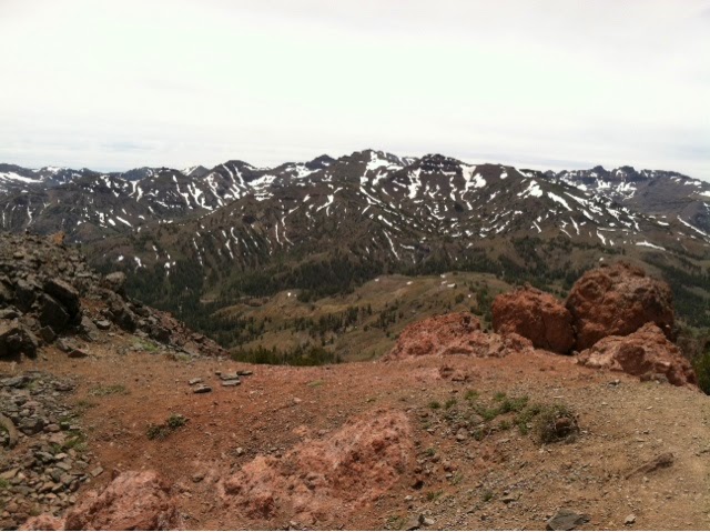


I keep entering different National Forests along the trail. This one surprised me. The Humboldt-Toiyabe National Forest is in an entirely different USFS Region. Also, I had never even heard of the Carson-Iceberg Wilderness.

Even though I didn't get started until 11:30 I still got 16 miles in. It felt good. The feet feel great and nearly three days with plentiful food and good company was good for the body and soul.
There weren't any thru-hikers today, which was strange after all the interaction last week. Right off I met with quite a few southbound day hikers, but that ended in just a couple of miles. Days of the week are generally meaningless on the trail, but it's obvious weekends near roads equates to more people.
An interesting couple from the south SF Bay Area did pass by heading southbound. He was involved with municipal fire before he retired, and had started his career with the Forest Service on the Shasta-Trinity in the early seventies. We knew many of the same same people because he has worked with various Incident Management Teams. The most amazing was Rich Farmer from Etna. He (AJ Barrien) knew Rich when he was real young growing up in Weaverville. I've known Rich since 1978. It's a small world.
June 22-Sunday-Resupply-Meeting Up With Other Thru-Hikers Again

These bouquets of violet and white flowers were scattered all over the boulders.

The Carson-Iceberg Wilderness isn't as popular as many of the others, so by being away from the road, and being off the John Muir Trail now, there was more solitude. It is still gorgeous, but not as unbelievably spectacular as some of the sites of the last three weeks.
I met up with Papa Bear as he was getting ready to head out for the day. We decided to have a cup of coffee and chat instead if hiking. It was great to reconnect. It's the same hike, but everyone has a different adventure. Different zeroes in different locations, hiking with different characters, injuries, timing, and a myriad of other variables make everyone's hike unique. Papa Bear is interesting in that he attempted the PCT thru-hike last year and just 300 miles before the Canada border the snows hit and he couldn't finish, so he's trying again this year.

Theresa, Debbie, and Debbie's three daughters hiked in four miles to meet me prior to the Hwy 4 (Ebbets Pass) crossing. Debbie even carried my pack for a mile or two. I'm spoiled.

They brought real food so I could have a great dinner. They also brought resupplies so I could make it all the way to Donner Pass (I-80) without the need to go in to South Lake Tahoe.
Theresa (BSCM) now heads home to Etna. Her support has been one of legend. She has had a great time with family and friends along the way, but, she has plans to stay incredibly busy back home!


After saying goodbye to everyone I continued north and into the Mokelumne Wilderness where I camped above Kinney Lakes. I met up with Robin (of Glen Pass fame), Kale, a set of brothers from Ohio, and Rocket Llama. It was fun to hear stories of others' adventures, and to hear how Robin did after Mather Pass (she did well) and to catch up on the hiking adventures of others.


More equestrians were on this stretch of the trail than any other so far. Most were from the Placerville area.

These two trail angels, Kermit and Jeannie Bug, came at just the right time. One of the southbound folks told me there was trail magic ahead, and I definitely picked up the pace. I had a hard time getting motivated prior to hearing that news, and had been hiking slowly.
They had Gatorade, soda, fruit, and homemade cookies. I left the trail angels with more spring in my step and made it quite a bit further before calling it a night.

June 24-Tuesday-to Hwy 50-Echo Pass
I met a southbound hiker and we started chatting. This happens often, and definitely slows down mileage, but I love meeting with folks. He was a recently retired Alcohol, Tobacco, and Firearms (ATF) agent. When I mentioned I just retired from the Forest Service he mentioned that he started his government career with the Forest Service.
I mentioned that I had worked in Happy Camp, and he lit up, he had worked in Happy Camp in the late seventies. I asked what his name was, Greg Barnett. I remembered him. I told him he had transferred from Happy Camp to the Los Padres NF, and that he had a brother Gary Barnett who also works for the USFS on the Tahoe NF. He was stunned. He wanted to know how I knew so much about him. I had worked with Gary in 1979 on the Scott River District of the Klamath Natonal Forest and he talked about his brother often. Once again, it's a small world.

Just before noon I made it to Hwy 88, Carson Pass. There is a Visitor Center there staffed by volunteers which is fabulous. They didn't have electricity to charge my phone, but they had trail magic. Fruit, soda, homemade cookies and great conversation. All the volunteers were teachers on summer break. I stayed there longer than I should have just chatting.


The first view of the south end of Lake Tahoe came just a few miles after Carson Pass.
After leaving the comforts of a chairs, and goodies, at Carson Pass I decided to push hard and get to Hwy 50 (Echo Pass) and either hitch a ride in to South Lake Tahoe or see what was available at Echo Lake for the night.
I made it to Hwy 50 at 8:00 p.m.. People drive fast on Hwy 50. Real fast. Hitchhiking is not easy there. I tried for an hour, and it got spooky as it got darker. I finally decided to give up and just hiked a bit further and called it a night without a much desired shower.
June 25-Wednesday-To Yogi, a verb


The Echo Lake Resort was not hiker friendly. The only water available you had to buy from bottles in the store, they didn't have a hiker box, and worst of all they didn't allow charging of cell phones or electronics. I offered to pay five dollars to charge my phone, they said no. They were definitely after a different clientele than the hiker crowd.
I had to yogi. To yogi means to beg, but it's not polite to beg, so hikers yogi instead. There was no power left on my phone. As guests arrived I scoped them out to see who might let me charge my phone in their car. Finally a group of three guys and a gal were hanging around a car. The one guy was wearing a SF Giants shirt, so I knew he was a good guy. My phone got a pretty good charge and I was able to head out on the trail.
I use the navigation applications on the phone, and knew there would be a need to contact the Magers and Ashley before the next chance to recharge. The power was essential.

These three little hikers were adorable with their packs and hiking poles (and ice cream). When I asked them if they could possibly be any cuter the one in pink said "yes, but I need my hands to be cuter, and they're full."

The Fellowship showed up at the Resort, Mr. Blister, Grande, Cacti and the fourth whose name I always forget.

I hiked leisurely with a couple of day hiking great ladies (Maureen and Mireille) from the Bay Area gawking at all the fabulous recreation residences along the shores of Echo Lake. There weren't many miles to be gained in the morning. We talked to one guy there and his family has had the cabin since 1947, what a treasure. My mind went to what a challenge it must be for the local Forest Service to administer!


The Desolation Wilderness is inappropriately named. In a picture above you can see a string of hikers. At one point I was able to see 18 other hikers at one time. This Wilderness area is noted for having the highest density of use per square mile of all designated Wilderness areas. The Tahoe Rim Trail (TRT) is a 165 mile long trail which circles the entire Lake Tahoe basin. For 50 miles the PCT and the TRT share the same tread. Like with the JMT, this means many more hikers, most heading southbound. Lots of stopping and talking.
Ogden Nash once wrote something like "I'd rather sit alone on a pumpkin than crowded on a cushion." The Desolation Wilderness is amazingly beautiful, and it is so easily accessible from the Lake Tahoe area that it has become a crowded cushion. I thought of my hike in May (just before Walker Pass) when I didn't see another person for a day and a half. That was my day alone on a pumpkin. Both experiences are worthwhile, and they are very different experiences.
.

Aloha Lake in the Desolation Wilderness seemed like a good spot to take a swim. It had been quite a while since I had the chance to get wet. Some other younger folks were swimming, and it seemed like a good idea. Right after I got in the cold wind started blowing. It helped dry me off, but it was mighty cold. It turns out it was the harbinger of the storm that came during the night.


June 26-Thursday-And Then It Rained!
It started raining about 3:00 a.m.. At about 6:00 a.m. It made sense to get hiking. It got a bit wet in the bivy sack and I felt it was better to hike and warm up rather than lay and get more wet and cold in the sleeping bag.
The pack was loaded up with wet gear.


As I was going up Dick's Pass I was passed by two seperate southbound TRT hikers. The first told me the winds and cold were much worse on the other side of the pass. The second told me once I got to the other side it was sheltered and much better. I marveled at the different perceptions. They had both been at the same place, at nearly the same time, experiencing the same storm, and had totally opposite ideas of what was there.
Dick's Pass was windy, wet, and cold.
I crossed the pass about 10:00 a.m.. When I got over the pass to the north it was much better, at least that was my perception:).

By the time I made it to Barker Pass at dusk it was obvious there would be no ride. I camped at the trailhead for the night.
June 27-Friday-I'm Going to Have a Granddaughter!

It was nice to have a picnic table and outhouse. I finished drying out all my gear in the morning. Firecracker and Tidy Camper came by and let me know where the others from our group were, and what they had been doing.

Another view of Lake Tahoe.


And even another view of Lake Tahoe, this time from Granite Chief Wilderness.


Cell service was virtually non-existent through much of the High Sierras, but in the Lake Tahoe area, with population centers and ski areas, service was much better. The problem was not having much battery power left in my I-Phone. Cell phone use for applications and communications were thus limited. My daughter, Ashley, had a doctor appointment to find out if I would have a grandson or a granddaughter. This cell tower above Squaw Valley was meant to be. I had great service, and enough battery power that I heard clearly when Ashley told me she's having a girl!

The trail runs right through the Wolverine ski run at Squaw Valley Ski Resort, the site of the 1960 Winter Olympics. At about the time I took this picture I heard the shout of "TORTUGA" from behind. Apparently the banner Sharleen Rainville made for the back of my pack makes it easy to distinguish me from great distances. It was Glitter reconnecting!
June 28-Saturday-Another Resupply by the Magers-Peter Grubb Hut

One last view of Lake Tahoe, this time from the north.

Donner Lake and some of the curves on historic Hwy 40 near Donner Pass.

Rock climbing practice in action.

John and Debbie Mager resupplied me at I-80. We went into Truckee to eat and shop, then they got me quickly back on the trail. The Magers, from Sonora, resupplied me at four key locations, Tuolumne Pass, Sonora Pass, Ebbetts Pass, and now Donner Pass. They drove a lot of miles to support my crazy efforts. John and Debbie are great friends!

The culvert crossing under I-80.

The Appalacian Trail (AT) has many shelters for hikers, the PCT does not. The Peter Grubb Hut is one of the few shelters on the PCT. When I arrived at dusk I could hear the banter and laughter coming from the upstairs. There were eight thru-hikers in the hut. The smell was memorable. The smell of a single thru-hiker can be overwhelming. Somewhere there is an appropriate word for the odor emanating from eight thru-hikers in a confined space. Eye-watering and gagging just don't seem to adequately describe it.
The shelters I saw on the AT were appropriately open. Staying in this confined shelter one night and I know why one hiker slept outside.
June 29-Sunday-Big Mile Day

One of the highlights of the Peter Grubb Hut was the two story outhouse. It's actually practical. One of the primary purposes of the cabin is for use by cross country skiers. During high snow events only the upstairs seat can be used. Just for novelty purposes I tested the upstairs room.

The hut is picturesque and unique.

Theresa gave me lessons in taping shin splints. Debbie Mager gave me good athletic tape. Within 24 hours I had successfully taped two with shin splints and been called a doctor:).


Some complained as the trail went through some private SPI land with recent logging. I opined repeatedly they did a fantastic job, with little residual damage, limited visible skid trails, hidden landings, nice trees remaining etc.. This could be a model for how logging can be done in sensitive areas. It again made me think of perceptions. My perception was that I loved seeing good logging.

A twenty-three mile day is a big day for me, so I was tired and slept well.
Today marked the end of my 13th week on the trail. The trail is 2600 + miles long, and I hope to finish in 26 weeks. I should theoretically be halfway done. Instead of being at 1300 miles, I'm just below 1200 miles. This last week I put in 135 miles. Miles are supposed to be easier now that the 10,000'+ passes of the High Sierras
are done. To complete the trail before the Washington snows will require consistent 100+ mile weeks.
June 30-Monday-Ten by Ten into Sierra City
With the thought of a breakfast with real food waiting in Sierra City I woke up early and was hiking a bit by headlamp. I made it over ten miles into a restaurant and devoured two breakfasts.


July 1-Tuesday-Zero Day in Sierra City
One of the reasons for the large gathering of hikers was the World Cup. All the Europeans wanted to be here, as well as many Americans because of the America vs Belgium game.

The entire crowd watching the World Cup game was thru-hikers. The Belgian kid won five dollars and serious bragging rights!

These two section hikers, Structure (Larry) and Bigfoot (Jim) are older than me! Structure is 77 years old, Bigfoot is 68 years old. I plan to hike out with them on Wednesday. Maybe I can keep up with them:).
Not everyone was impressed with Sierra City. I loved it. Perceptions? Expectations? Some thought that with "City" in the name it would have amenities like a functioning ATM, regular store hours, and a post office that was open for more than four hours a day.

I had a slow leak in my air mattress that was mighty annoying. There wasn't a bathtub in the hotel so I went down to the Yuba River below the hotel to spot te bubbles. Bubbles were found, and the mattress was hopefully repaired.

This sign caught my eye just outside the Red Moose Cafe in Sierra City. I'm still "Livin' The Dream." The mileage never seems to match between the data book, and the different applications. This sign doesn't match anything, but it's close.